Sailopia.com - Dana Point, CA. Offshore Buoy Weather Reports for Sailors and Boaters.
Station 46277 - GREEN BEACH OFFSHORE, CA (271)
April 25, 2024 3:56 am PST
Location: 33.336N 117.659W or 9 nautical miles SSE of search location of 33.47N 117.74W.
Significant Wave Height: 3 ft
Dominant Wave Period: 14 sec
Average Period: 5.6 sec
Mean Wave Direction: S (190°)
Water Temperature: 60°F (15.6°C)
Station 46275 - RED BEACH NEARSHORE, CA (264)
April 25, 2024 4:00 am PST
Location: 33.29N 117.5W or 16 nautical miles SE of search location of 33.47N 117.74W.
Significant Wave Height: 3 ft
Dominant Wave Period: 15 sec
Average Period: 5.5 sec
Mean Wave Direction: SW (217°)
Water Temperature: 60°F (15.4°C)
Station 46224 - OCEANSIDE OFFSHORE, CA (045)
April 25, 2024 4:26 am PST
Location: 33.178N 117.472W or 22 nautical miles SE of search location of 33.47N 117.74W.
Significant Wave Height: 3 ft
Dominant Wave Period: 15 sec
Average Period: 5.5 sec
Mean Wave Direction: S (188°)
Water Temperature: 62°F (16.8°C)
Station 46253 - SAN PEDRO SOUTH, CA (213)
April 25, 2024 4:26 am PST
Location: 33.576N 118.181W or 23 nautical miles WNW of search location of 33.47N 117.74W.
Significant Wave Height: 4 ft
Dominant Wave Period: 15 sec
Average Period: 5.7 sec
Mean Wave Direction: S (170°)
Water Temperature: 58°F (14.2°C)
Station 46256 - LONG BEACH CHANNEL, CA (215)
April 25, 2024 4:26 am PST
Location: 33.7N 118.201W or 27 nautical miles WNW of search location of 33.47N 117.74W.
Significant Wave Height: 4 ft
Dominant Wave Period: 15 sec
Average Period: 8.5 sec
Mean Wave Direction: SSW (194°)
Water Temperature: 57°F (13.8°C)
SHIP
April 25, 2024 12:00 UTC
Location: 33.7N 118.2W or 27 nautical miles WNW of search location of 33.47N 117.74W.
Atmospheric Pressure: 30.11 in (1019.7 mb)
Pressure Tendency: -0.01 in (-0.5 mb)
Air Temperature: 57°F (13.9°C)
Dew Point: 56°F (13.5°C)
SHIP
April 25, 2024 11:00 UTC
Location: 33.7N 118.2W or 27 nautical miles WNW of search location of 33.47N 117.74W.
Atmospheric Pressure: 30.11 in (1019.8 mb)
Pressure Tendency: -0.02 in (-0.8 mb)
Air Temperature: 56°F (13.5°C)
Dew Point: 56°F (13.5°C)
Station AGXC1 - 9410647 - ANGELS GATE, CA
April 25, 2024 3:54 am PST
Location: 33.716N 118.246W or 29 nautical miles WNW of search location of 33.47N 117.74W.
Wind Direction: WSW (240°)
Wind Speed: 5 knots
Wind Gust: 8 knots
Air Temperature: 58°F (14.3°C)
Station 46222 - SAN PEDRO, CA (092)
April 25, 2024 3:56 am PST
Location: 33.618N 118.317W or 30 nautical miles WNW of search location of 33.47N 117.74W.
Significant Wave Height: 3 ft
Dominant Wave Period: 6 sec
Average Period: 4.7 sec
Mean Wave Direction: W (281°)
Water Temperature: 58°F (14.3°C)
Station PFDC1 - 9410666 - LOS ANGELES PIER 400, CA
April 25, 2024 3:54 am PST
Location: 33.735N 118.241W or 30 nautical miles WNW of search location of 33.47N 117.74W.
Wind Direction: SSW (200°)
Wind Speed: 4 knots
Wind Gust: 6 knots
Station BAXC1 - 9410691 - LOS ANGELES BADGER AVENUE BRIDGE
April 25, 2024 3:54 am PST
Location: 33.766N 118.24W or 31 nautical miles NW of search location of 33.47N 117.74W.
Wind Direction: SW (220°)
Wind Speed: 5 knots
Wind Gust: 7 knots
Station 46274 - LEUCADIA NEARSHORE, CA (262)
April 25, 2024 4:26 am PST
Location: 33.062N 117.314W or 32 nautical miles SE of search location of 33.47N 117.74W.
Significant Wave Height: 2 ft
Dominant Wave Period: 15 sec
Average Period: 5.2 sec
Mean Wave Direction: SW (228°)
Water Temperature: 61°F (16.3°C)
Station PXAC1 - 9410690 - LOS ANGELES BERTH 161, CA
April 25, 2024 3:54 am PST
Location: 33.764N 118.265W or 32 nautical miles NW of search location of 33.47N 117.74W.
Wind Direction: SW (220°)
Wind Speed: 3 knots
Wind Gust: 5 knots
Station 46225 - TORREY PINES OUTER, CA (100)
April 25, 2024 4:26 am PST
Location: 32.933N 117.391W or 37 nautical miles SSE of search location of 33.47N 117.74W.
Significant Wave Height: 4 ft
Dominant Wave Period: 14 sec
Average Period: 5.2 sec
Mean Wave Direction: SSW (199°)
Water Temperature: 62°F (16.5°C)
Station 46266 - DEL MAR NEARSHORE, CA (153)
April 25, 2024 4:26 am PST
Location: 32.957N 117.279W or 39 nautical miles SE of search location of 33.47N 117.74W.
Significant Wave Height: 3 ft
Dominant Wave Period: 14 sec
Average Period: 4.9 sec
Mean Wave Direction: SW (230°)
Water Temperature: 62°F (16.4°C)
Station 46273 - TORREY PINES INNER, CA (101)
April 25, 2024 3:56 am PST
Location: 32.93N 117.274W or 40 nautical miles SE of search location of 33.47N 117.74W.
Significant Wave Height: 3 ft
Dominant Wave Period: 14 sec
Average Period: 4.8 sec
Mean Wave Direction: SW (226°)
Water Temperature: 62°F (16.4°C)
Station 46254 - SCRIPPS NEARSHORE, CA (201)
April 25, 2024 4:26 am PST
Location: 32.868N 117.267W or 43 nautical miles SSE of search location of 33.47N 117.74W.
Significant Wave Height: 3 ft
Dominant Wave Period: 5 sec
Average Period: 4.3 sec
Mean Wave Direction: WNW (282°)
Water Temperature: 62°F (16.8°C)
Station LJAC1 - 9410230 - LA JOLLA, CA
April 25, 2024 4:00 am PST
Location: 32.867N 117.257W or 44 nautical miles SE of search location of 33.47N 117.74W.
Wind Direction: W (270°)
Wind Speed: 11 knots
Wind Gust: 14 knots
Atmospheric Pressure: 30.05 in (1017.5 mb)
Pressure Tendency: +0.00 in (-0.0 mb)
Air Temperature: 59°F (14.9°C)
Water Temperature: 62°F (16.9°C)
Station LJPC1 - LA JOLLA, CA (073)
April 25, 2024 4:20 am PST
Location: 32.867N 117.257W or 44 nautical miles SE of search location of 33.47N 117.74W.
Wind Direction: WNW (290°)
Wind Speed: 11 knots
Wind Gust: 15 knots
Significant Wave Height: 3 ft
Dominant Wave Period: 5 sec
Average Period: 4.4 sec
Station 46258 - MISSION BAY WEST, CA (220)
April 25, 2024 4:26 am PST
Location: 32.749N 117.502W or 45 nautical miles SSE of search location of 33.47N 117.74W.
Significant Wave Height: 4 ft
Dominant Wave Period: 14 sec
Average Period: 5.6 sec
Mean Wave Direction: SSW (194°)
Water Temperature: 62°F (16.4°C)
Station ICAC1 - 9410840 - SANTA MONICA PIER
April 25, 2024 4:00 am PST
Location: 34.008N 118.5W or 50 nautical miles NW of search location of 33.47N 117.74W.
Atmospheric Pressure: 30.02 in (1016.6 mb)
Pressure Tendency: -0.02 in (-0.7 mb)
Air Temperature: 56°F (13.1°C)
Water Temperature: 59°F (15.1°C)
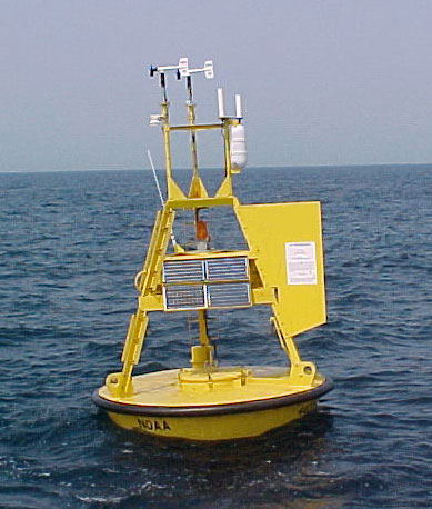
Sailopia.com receives it's data from the NOAA and includes wind, wave, and other marine data collected by the NOAA National Data Buoy Center (NDBC). The data are collected from NDBC moored buoys and from C-MAN (Coastal-Marine Automated Network) stations located on piers, offshore towers, lighthouses, and beaches. Parameters reported by both buoys and C-MAN stations include air temperature and pressure, wind speed and direction, wind gust, and sea surface temperature.
Something of Interest
Sailing is one of the most eco-friendly sports on the planet! with more than 5000 year old technology the sport of sailing is becoming ever more popular in the technological based world. There is nothing greater than to spend a relaxing day on the water!