Sailopia.com - Port Ludlow, WA. Offshore Buoy Weather Reports for Sailors and Boaters.
Station PTWW1 - 9444900 - PORT TOWNSEND, WA
April 19, 2024 10:30 am PST
Location: 48.111N 122.76W or 12 nautical miles N of search location of 47.91N 122.76W.
Wind Direction: NNE (30°)
Wind Speed: 3 knots
Wind Gust: 5 knots
Atmospheric Pressure: 30.23 in (1023.7 mb)
Air Temperature: 59°F (15.0°C)
Water Temperature: 49°F (9.4°C)
Station WPOW1 - WEST POINT, WA
April 19, 2024 10:00 am PST
Location: 47.662N 122.436W or 20 nautical miles SE of search location of 47.91N 122.76W.
Wind Direction: NE (40°)
Wind Speed: 9 knots
Wind Gust: 9 knots
Atmospheric Pressure: 30.20 in (1022.7 mb)
Pressure Tendency: -0.03 in (-0.9 mb)
Air Temperature: 52°F (11.1°C)
Dew Point: 43°F (6.1°C)
Station BMTW1 - 9445958 - BREMERTON, WA
April 19, 2024 10:30 am PST
Location: 47.562N 122.626W or 22 nautical miles SSE of search location of 47.91N 122.76W.
Atmospheric Pressure: 30.20 in (1022.7 mb)
SHIP
April 19, 2024 18:00 UTC
Location: 48.1N 123.3W or 24 nautical miles WNW of search location of 47.91N 122.76W.
Atmospheric Pressure: 30.27 in (1025.0 mb)
Pressure Tendency: +0.06 in (+1.9 mb)
Air Temperature: 54°F (12.3°C)
Dew Point: 41°F (5.1°C)
Station SISW1 - SMITH ISLAND, WA
April 19, 2024 10:40 am PST
Location: 48.321N 122.831W or 25 nautical miles N of search location of 47.91N 122.76W.
Wind Direction: NNE (20°)
Wind Speed: 9 knots
Wind Gust: 11 knots
Atmospheric Pressure: 30.22 in (1023.3 mb)
Air Temperature: 51°F (10.6°C)
Dew Point: 42°F (5.6°C)
Station 46088 - NEW DUNGENESS - 17 NM NE OF PORT ANGELES, WA
April 19, 2024 10:30 am PST
Location: 48.332N 123.179W or 30 nautical miles NNW of search location of 47.91N 122.76W.
Wind Direction: N (350°)
Wind Speed: 12 knots
Wind Gust: 14 knots
Atmospheric Pressure: 30.24 in (1023.9 mb)
Air Temperature: 50°F (9.9°C)
Dew Point: 40°F (4.6°C)
Water Temperature: 49°F (9.6°C)
Station PTAW1 - 9444090 - PORT ANGELES, WA
April 19, 2024 10:30 am PST
Location: 48.125N 123.441W or 30 nautical miles WNW of search location of 47.91N 122.76W.
Atmospheric Pressure: 30.24 in (1024.1 mb)
Air Temperature: 50°F (10.2°C)
Water Temperature: 49°F (9.3°C)
Station PBFW1 - PADILLA BAY FARM, PADILLA BAY RESERVE, WA
April 19, 2024 10:30 am PST
Location: 48.464N 122.469W or 35 nautical miles NNE of search location of 47.91N 122.76W.
Wind Direction: N (360°)
Wind Speed: 10 knots
Atmospheric Pressure: 30.21 in (1023.0 mb)
Air Temperature: 53°F (11.9°C)
Dew Point: 38°F (3.5°C)
Station 46267 - ANGELES POINT, WA (248)
April 19, 2024 10:30 am PST
Location: 48.173N 123.607W or 37 nautical miles WNW of search location of 47.91N 122.76W.
Significant Wave Height: 1 ft
Dominant Wave Period: 10 sec
Average Period: 4.2 sec
Mean Wave Direction: WNW (287°)
Air Temperature: 49°F (9.3°C)
Water Temperature: 48°F (8.9°C)
Station FRDW1 - 9449880 - FRIDAY HARBOR, WA
April 19, 2024 10:30 am PST
Location: 48.545N 123.012W or 39 nautical miles NNW of search location of 47.91N 122.76W.
Wind Direction: NNE (30°)
Wind Speed: 4 knots
Wind Gust: 6 knots
Atmospheric Pressure: 30.24 in (1023.9 mb)
Air Temperature: 56°F (13.3°C)
Water Temperature: 49°F (9.3°C)
Station TCMW1 - 9446482 - TACOMA MET, WA
April 19, 2024 10:18 am PST
Location: 47.276N 122.418W or 40 nautical miles SSE of search location of 47.91N 122.76W.
Wind Direction: NE (40°)
Wind Speed: 8 knots
Wind Gust: 17 knots
Air Temperature: 60°F (15.3°C)
Station TCNW1 - 9446484 - TACOMA, WA
April 19, 2024 10:30 am PST
Location: 47.267N 122.413W or 41 nautical miles SSE of search location of 47.91N 122.76W.
Atmospheric Pressure: 30.17 in (1021.8 mb)
Water Temperature: 50°F (10.0°C)
SHIP
April 19, 2024 18:00 UTC
Location: 47.2N 122.4W or 45 nautical miles SSE of search location of 47.91N 122.76W.
Atmospheric Pressure: 30.15 in (1021.1 mb)
Pressure Tendency: -0.04 in (-1.4 mb)
Air Temperature: 61°F (16.1°C)
Dew Point: 33°F (0.7°C)
SHIP
April 19, 2024 18:00 UTC
Location: 47.2N 122.3W or 46 nautical miles SSE of search location of 47.91N 122.76W.
Atmospheric Pressure: 30.19 in (1022.2 mb)
Pressure Tendency: -0.04 in (-1.4 mb)
Air Temperature: 64°F (17.5°C)
Dew Point: 39°F (3.8°C)
Your search included the Coastal area of Port Ludlow, WA.
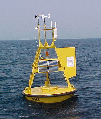
Sailopia.com receives it's data from the NOAA and includes wind, wave, and other marine data collected by the NOAA National Data Buoy Center (NDBC). The data are collected from NDBC moored buoys and from C-MAN (Coastal-Marine Automated Network) stations located on piers, offshore towers, lighthouses, and beaches. Parameters reported by both buoys and C-MAN stations include air temperature and pressure, wind speed and direction, wind gust, and sea surface temperature.
Something of Interest
Sailing is one of the most eco-friendly sports on the planet! with more than 5000 year old technology the sport of sailing is becoming ever more popular in the technological based world. There is nothing greater than to spend a relaxing day on the water!