Sailopia.com - Canada BC West Coast Offshore Buoy Weather Reports for Sailors and Boaters.
Station 46146 - HALIBUT BANK
April 25, 2024 2:00 pm PST
Location: 49.34N 123.73W or 3 nautical miles NNW of search location of 49.3N 123.7W.
Wind Direction: ENE (70°)
Wind Speed: 16 knots
Wind Gust: 17 knots
Significant Wave Height: 2 ft
Dominant Wave Period: 3 sec
Atmospheric Pressure: 29.75 in (1007.6 mb)
Air Temperature: 50°F (9.9°C)
Water Temperature: 51°F (10.8°C)
Station 46304 - ENTRANCE TO ENGLISH BAY
April 25, 2024 22:00 UTC
Location: 49.3N 123.36W or 13 nautical miles E of search location of 49.3N 123.7W.
Wind Direction: NNE (30°)
Wind Speed: 16 knots
Wind Gust: 17 knots
Significant Wave Height: 1 ft
Dominant Wave Period: 3 sec
Atmospheric Pressure: 29.78 in (1008.3 mb)
Pressure Tendency: -0.02 in (-0.8 mb)
Air Temperature: 49°F (9.2°C)
Water Temperature: 51°F (10.7°C)
Station 46303 - SOUTHERN GEORGIA STRAIT
April 25, 2024 22:00 UTC
Location: 49.02N 123.43W or 20 nautical miles SSE of search location of 49.3N 123.7W.
Wind Direction: E (90°)
Wind Speed: 12 knots
Wind Gust: 14 knots
Significant Wave Height: 2 ft
Dominant Wave Period: 3 sec
Atmospheric Pressure: 29.77 in (1008.0 mb)
Pressure Tendency: -0.04 in (-1.2 mb)
Air Temperature: 50°F (10.1°C)
Water Temperature: 51°F (10.8°C)
SHIP
April 25, 2024 21:00 UTC
Location: 48.6N 123.4W or 44 nautical miles SSE of search location of 49.3N 123.7W.
Wind Direction: NNE (30°)
Wind Speed: 1 knots
Atmospheric Pressure: 29.77 in (1008.2 mb)
Pressure Tendency: -0.03 in (-1.1 mb)
Air Temperature: 50°F (10.0°C)
Dew Point: 48°F (9.0°C)
SHIP
April 25, 2024 22:00 UTC
Location: 48.6N 123.4W or 44 nautical miles SSE of search location of 49.3N 123.7W.
Wind Direction: ENE (70°)
Wind Speed: 7 knots
Atmospheric Pressure: 29.76 in (1007.9 mb)
Pressure Tendency: -0.03 in (-1.1 mb)
Air Temperature: 49°F (9.7°C)
Dew Point: 48°F (9.0°C)
Station CHYW1 - 9449424 - CHERRY POINT, WA
April 25, 2024 2:00 pm PST
Location: 48.863N 122.759W or 45 nautical miles SE of search location of 49.3N 123.7W.
Atmospheric Pressure: 29.76 in (1007.9 mb)
Pressure Tendency: -0.02 in (-0.7 mb)
Station CPNW1 - 9449427 - CHERRY POINT NORTH DOCK MET
April 25, 2024 2:00 pm PST
Location: 48.863N 122.758W or 45 nautical miles SE of search location of 49.3N 123.7W.
Wind Direction: SE (130°)
Wind Speed: 10 knots
Wind Gust: 14 knots
Air Temperature: 51°F (10.4°C)
Station CPMW1 - 9449419 - CHERRY POINT SOUTH DOCK MET, WA
April 25, 2024 2:00 pm PST
Location: 48.86N 122.756W or 46 nautical miles SE of search location of 49.3N 123.7W.
Wind Direction: SE (140°)
Wind Speed: 13 knots
Wind Gust: 15 knots
Air Temperature: 51°F (10.4°C)
Station FRDW1 - 9449880 - FRIDAY HARBOR, WA
April 25, 2024 1:36 pm PST
Location: 48.545N 123.012W or 53 nautical miles SSE of search location of 49.3N 123.7W.
Wind Direction: ENE (70°)
Wind Speed: 6 knots
Wind Gust: 7 knots
Atmospheric Pressure: 29.77 in (1008.2 mb)
Air Temperature: 49°F (9.3°C)
Water Temperature: 49°F (9.4°C)
SHIP
April 25, 2024 21:00 UTC
Location: 48.6N 122.6W or 60 nautical miles SE of search location of 49.3N 123.7W.
Atmospheric Pressure: 29.81 in (1009.5 mb)
Pressure Tendency: -0.01 in (-0.2 mb)
Air Temperature: 50°F (9.8°C)
Dew Point: 47°F (8.5°C)
SHIP
April 25, 2024 22:00 UTC
Location: 48.6N 122.6W or 60 nautical miles SE of search location of 49.3N 123.7W.
Atmospheric Pressure: 29.80 in (1009.2 mb)
Pressure Tendency: -0.01 in (-0.2 mb)
Air Temperature: 49°F (9.5°C)
Dew Point: 47°F (8.2°C)
SHIP
April 25, 2024 22:00 UTC
Location: 48.3N 123.4W or 61 nautical miles SSE of search location of 49.3N 123.7W.
Atmospheric Pressure: 29.74 in (1007.0 mb)
Pressure Tendency: +0.00 in (-0.0 mb)
Air Temperature: 50°F (10.2°C)
Dew Point: 50°F (9.8°C)
Station 46088 - NEW DUNGENESS - 17 NM NE OF PORT ANGELES, WA
April 25, 2024 2:20 pm PST
Location: 48.332N 123.179W or 62 nautical miles SSE of search location of 49.3N 123.7W.
Wind Direction: NNE (20°)
Wind Speed: 6 knots
Wind Gust: 8 knots
Significant Wave Height: 1 ft
Average Period: 3.6 sec
Atmospheric Pressure: 29.75 in (1007.3 mb)
Air Temperature: 48°F (8.7°C)
Dew Point: 46°F (7.8°C)
Water Temperature: 49°F (9.4°C)
Station 46131 - SENTRY SHOAL
April 25, 2024 2:00 pm PST
Location: 49.91N 124.98W or 62 nautical miles NW of search location of 49.3N 123.7W.
Wind Direction: ESE (110°)
Wind Speed: 2 knots
Wind Gust: 4 knots
Significant Wave Height: 0 ft
Dominant Wave Period: 3 sec
Atmospheric Pressure: 29.77 in (1008.2 mb)
Pressure Tendency: -0.03 in (-0.9 mb)
Air Temperature: 48°F (9.1°C)
Water Temperature: 50°F (10.2°C)
SHIP
April 25, 2024 22:00 UTC
Location: 48.3N 124.1W or 62 nautical miles SSW of search location of 49.3N 123.7W.
Atmospheric Pressure: 29.75 in (1007.4 mb)
Pressure Tendency: +0.01 in (+0.3 mb)
Air Temperature: 49°F (9.4°C)
Dew Point: 47°F (8.1°C)
Station 46087 - NEAH BAY - 6 NM NORTH OF CAPE FLATTERY, WA (TRAFFIC SEPARATION LIGHTED BUOY)
April 25, 2024 2:10 pm PST
Location: 48.493N 124.727W or 63 nautical miles SW of search location of 49.3N 123.7W.
Wind Direction: ESE (110°)
Wind Speed: 14 knots
Wind Gust: 17 knots
Atmospheric Pressure: 29.69 in (1005.5 mb)
SHIP
April 25, 2024 21:00 UTC
Location: 48.4N 124.5W or 63 nautical miles SSW of search location of 49.3N 123.7W.
Atmospheric Pressure: 29.75 in (1007.3 mb)
Pressure Tendency: +0.02 in (+0.6 mb)
Air Temperature: 49°F (9.3°C)
Dew Point: 46°F (7.9°C)
SHIP
April 25, 2024 21:00 UTC
Location: 48.2N 123.6W or 66 nautical miles S of search location of 49.3N 123.7W.
Atmospheric Pressure: 29.75 in (1007.4 mb)
Pressure Tendency: +0.01 in (+0.5 mb)
Air Temperature: 50°F (9.9°C)
Dew Point: 50°F (9.9°C)
Station NEAW1 - 9443090 - NEAH BAY, WA
April 25, 2024 2:00 pm PST
Location: 48.367N 124.614W or 67 nautical miles SSW of search location of 49.3N 123.7W.
Atmospheric Pressure: 29.70 in (1005.7 mb)
Pressure Tendency: -0.04 in (-1.3 mb)
Water Temperature: 50°F (10.0°C)
SHIP
April 25, 2024 22:00 UTC
Location: 48.2N 123.4W or 67 nautical miles S of search location of 49.3N 123.7W.
Atmospheric Pressure: 29.73 in (1006.7 mb)
Pressure Tendency: -0.05 in (-1.6 mb)
Air Temperature: 55°F (12.5°C)
Dew Point: 50°F (9.9°C)
SHIP
April 25, 2024 21:00 UTC
Location: 48.5N 122.5W or 67 nautical miles SE of search location of 49.3N 123.7W.
Atmospheric Pressure: 29.78 in (1008.6 mb)
Pressure Tendency: -0.01 in (-0.2 mb)
Air Temperature: 51°F (10.5°C)
Dew Point: 47°F (8.1°C)
SHIP
April 25, 2024 21:00 UTC
Location: 48.5N 122.5W or 67 nautical miles SE of search location of 49.3N 123.7W.
Atmospheric Pressure: 29.76 in (1007.7 mb)
Pressure Tendency: -0.01 in (-0.3 mb)
Air Temperature: 55°F (12.9°C)
Dew Point: 52°F (11.2°C)
SHIP
April 25, 2024 22:00 UTC
Location: 48.5N 122.5W or 67 nautical miles SE of search location of 49.3N 123.7W.
Atmospheric Pressure: 29.77 in (1008.2 mb)
Pressure Tendency: -0.01 in (-0.4 mb)
Air Temperature: 51°F (10.5°C)
Dew Point: 47°F (8.2°C)
SHIP
April 25, 2024 22:00 UTC
Location: 48.5N 122.5W or 67 nautical miles SE of search location of 49.3N 123.7W.
Atmospheric Pressure: 29.75 in (1007.5 mb)
Pressure Tendency: -0.01 in (-0.4 mb)
Air Temperature: 55°F (12.7°C)
Dew Point: 52°F (11.3°C)
Station 46267 - ANGELES POINT, WA (248)
April 25, 2024 2:00 pm PST
Location: 48.173N 123.607W or 68 nautical miles S of search location of 49.3N 123.7W.
Significant Wave Height: 1 ft
Dominant Wave Period: 9 sec
Average Period: 6.9 sec
Mean Wave Direction: WNW (284°)
Air Temperature: 48°F (8.9°C)
Water Temperature: 48°F (8.9°C)
Station SISW1 - SMITH ISLAND, WA
April 25, 2024 2:20 pm PST
Location: 48.321N 122.831W or 68 nautical miles SSE of search location of 49.3N 123.7W.
Wind Direction: SSE (150°)
Wind Speed: 15 knots
Wind Gust: 19 knots
Atmospheric Pressure: 29.74 in (1007.1 mb)
Air Temperature: 52°F (11.3°C)
Dew Point: 50°F (10.1°C)
SHIP
April 25, 2024 21:00 UTC
Location: 48.2N 123.2W or 69 nautical miles SSE of search location of 49.3N 123.7W.
Atmospheric Pressure: 29.75 in (1007.6 mb)
Pressure Tendency: -0.03 in (-1.0 mb)
Air Temperature: 49°F (9.7°C)
Dew Point: 49°F (9.3°C)
Station PBFW1 - PADILLA BAY FARM, PADILLA BAY RESERVE, WA
April 25, 2024 1:30 pm PST
Location: 48.464N 122.469W or 70 nautical miles SE of search location of 49.3N 123.7W.
Wind Direction: S (170°)
Wind Speed: 10 knots
Atmospheric Pressure: 29.77 in (1008.0 mb)
Air Temperature: 53°F (11.6°C)
Dew Point: 49°F (9.5°C)
Station PTAW1 - 9444090 - PORT ANGELES, WA
April 25, 2024 1:36 pm PST
Location: 48.125N 123.441W or 71 nautical miles S of search location of 49.3N 123.7W.
Atmospheric Pressure: 29.77 in (1008.0 mb)
Air Temperature: 52°F (11.1°C)
Water Temperature: 49°F (9.6°C)
Station PTWW1 - 9444900 - PORT TOWNSEND, WA
April 25, 2024 2:00 pm PST
Location: 48.111N 122.76W or 80 nautical miles SSE of search location of 49.3N 123.7W.
Wind Direction: SE (130°)
Wind Speed: 18 knots
Wind Gust: 21 knots
Atmospheric Pressure: 29.76 in (1007.9 mb)
Pressure Tendency: -0.04 in (-1.2 mb)
Air Temperature: 53°F (11.8°C)
Water Temperature: 49°F (9.6°C)
Station LAPW1 - 9442396 - LA PUSH, WA
April 25, 2024 1:36 pm PST
Location: 47.913N 124.637W or 91 nautical miles SSW of search location of 49.3N 123.7W.
Wind Direction: SE (140°)
Wind Speed: 12 knots
Wind Gust: 17 knots
Atmospheric Pressure: 29.69 in (1005.5 mb)
Air Temperature: 51°F (10.3°C)
Water Temperature: 50°F (10.1°C)
Station 46206 - LA PEROUSE BANK
April 25, 2024 2:00 pm PST
Location: 48.84N 126W or 95 nautical miles WSW of search location of 49.3N 123.7W.
Wind Direction: SE (140°)
Wind Speed: 14 knots
Wind Gust: 17 knots
Significant Wave Height: 4 ft
Dominant Wave Period: 7 sec
Atmospheric Pressure: 29.67 in (1004.6 mb)
Pressure Tendency: -0.03 in (-0.9 mb)
Air Temperature: 51°F (10.5°C)
Water Temperature: 51°F (10.4°C)
Station DESW1 - DESTRUCTION ISLAND, WA
April 25, 2024 4:00 pm CST
Location: 47.675N 124.485W or 102 nautical miles SSW of search location of 49.3N 123.7W.
Wind Direction: SSE (150°)
Wind Speed: 19 knots
Wind Gust: 21 knots
Atmospheric Pressure: 29.68 in (1005.1 mb)
Pressure Tendency: -0.06 in (-2.2 mb)
SHIP
April 25, 2024 22:00 UTC
Location: 47.7N 122.4W or 109 nautical miles SSE of search location of 49.3N 123.7W.
Wind Direction: S (170°)
Wind Speed: 9 knots
Atmospheric Pressure: 29.69 in (1005.5 mb)
Pressure Tendency: -0.04 in (-1.5 mb)
Air Temperature: 53°F (11.6°C)
Dew Point: 46°F (7.9°C)
SHIP
April 25, 2024 21:00 UTC
Location: 47.7N 122.4W or 109 nautical miles SSE of search location of 49.3N 123.7W.
Wind Direction: S (180°)
Wind Speed: 7 knots
Atmospheric Pressure: 29.71 in (1006.0 mb)
Pressure Tendency: -0.03 in (-1.0 mb)
Air Temperature: 52°F (11.2°C)
Dew Point: 47°F (8.4°C)
Station WPOW1 - WEST POINT, WA
April 25, 2024 2:00 pm PST
Location: 47.662N 122.436W or 110 nautical miles SSE of search location of 49.3N 123.7W.
Wind Direction: S (180°)
Wind Speed: 19 knots
Wind Gust: 21 knots
Atmospheric Pressure: 29.78 in (1008.5 mb)
Pressure Tendency: -0.04 in (-1.4 mb)
Air Temperature: 52°F (11.1°C)
Dew Point: 50°F (10.2°C)
Station BMTW1 - 9445958 - BREMERTON, WA
April 25, 2024 2:00 pm PST
Location: 47.562N 122.626W or 113 nautical miles SSE of search location of 49.3N 123.7W.
Wind Direction: NNE (20°)
Wind Speed: 7 knots
Wind Gust: 14 knots
Atmospheric Pressure: 29.80 in (1009.0 mb)
Pressure Tendency: -0.04 in (-1.3 mb)
Air Temperature: 53°F (11.5°C)
SHIP
April 25, 2024 21:00 UTC
Location: 48.4N 126.2W or 113 nautical miles WSW of search location of 49.3N 123.7W.
Atmospheric Pressure: 29.65 in (1004.1 mb)
Pressure Tendency: +0.01 in (+0.2 mb)
Air Temperature: 54°F (12.2°C)
Dew Point: 49°F (9.3°C)
Station 46041 - CAPE ELIZABETH - 45NM NW OF ABERDEEN, WA
April 25, 2024 2:10 pm PST
Location: 47.352N 124.739W or 124 nautical miles SSW of search location of 49.3N 123.7W.
Wind Direction: S (190°)
Wind Speed: 16 knots
Wind Gust: 21 knots
Significant Wave Height: 7 ft
Average Period: 5.6 sec
Mean Wave Direction: SW (215°)
Atmospheric Pressure: 29.67 in (1004.9 mb)
Air Temperature: 51°F (10.5°C)
SHIP
April 25, 2024 21:00 UTC
Location: 49.1N 126.9W or 126 nautical miles W of search location of 49.3N 123.7W.
Atmospheric Pressure: 29.66 in (1004.4 mb)
Pressure Tendency: -0.04 in (-1.4 mb)
Air Temperature: 54°F (12.2°C)
Dew Point: 49°F (9.2°C)
Station TCMW1 - 9446482 - TACOMA MET, WA
April 25, 2024 1:30 pm PST
Location: 47.276N 122.418W or 132 nautical miles SSE of search location of 49.3N 123.7W.
Wind Direction: S (190°)
Wind Speed: 5 knots
Wind Gust: 13 knots
Air Temperature: 53°F (11.5°C)
Station TCNW1 - 9446484 - TACOMA, WA
April 25, 2024 2:00 pm PST
Location: 47.267N 122.413W or 132 nautical miles SSE of search location of 49.3N 123.7W.
Atmospheric Pressure: 29.81 in (1009.6 mb)
Pressure Tendency: -0.05 in (-1.6 mb)
Water Temperature: 50°F (10.2°C)
SHIP
April 25, 2024 22:00 UTC
Location: 49.4N 127.1W or 133 nautical miles W of search location of 49.3N 123.7W.
Atmospheric Pressure: 29.66 in (1004.4 mb)
Pressure Tendency: -0.03 in (-1.0 mb)
Air Temperature: 55°F (12.5°C)
Dew Point: 48°F (9.0°C)
Station 46099 - OOI WESTPORT SHELF
April 25, 2024 11:50 am PST
Location: 46.988N 124.567W or 143 nautical miles SSW of search location of 49.3N 123.7W.
Wind Direction: S (170°)
Wind Speed: 17 knots
Atmospheric Pressure: 29.70 in (1005.8 mb)
Air Temperature: 50°F (10.2°C)
Water Temperature: 51°F (10.8°C)
Station WPTW1 - 9441102 - WESTPORT, WA
April 25, 2024 1:36 pm PST
Location: 46.904N 124.105W or 145 nautical miles S of search location of 49.3N 123.7W.
Wind Direction: S (180°)
Wind Speed: 14 knots
Wind Gust: 27 knots
Atmospheric Pressure: 29.72 in (1006.4 mb)
Air Temperature: 50°F (10.1°C)
Water Temperature: 52°F (11.3°C)
Station 46211 - GRAYS HARBOR, WA (036)
April 25, 2024 1:56 pm PST
Location: 46.857N 124.244W or 148 nautical miles S of search location of 49.3N 123.7W.
Significant Wave Height: 8 ft
Dominant Wave Period: 6 sec
Water Temperature: 52°F (11.0°C)
Station 46100 - OOI WESTPORT OFFSHORE
April 25, 2024 12:30 pm PST
Location: 46.851N 124.964W or 155 nautical miles SSW of search location of 49.3N 123.7W.
Wind Direction: SSW (210°)
Wind Speed: 16 knots
Atmospheric Pressure: 29.65 in (1004.1 mb)
Air Temperature: 52°F (11.0°C)
Water Temperature: 52°F (11.2°C)
Station TOKW1 - 9440910 - TOKE POINT, WA
April 25, 2024 2:00 pm PST
Location: 46.707N 123.967W or 156 nautical miles S of search location of 49.3N 123.7W.
Wind Direction: S (180°)
Wind Speed: 21 knots
Wind Gust: 26 knots
Atmospheric Pressure: 29.77 in (1008.0 mb)
Pressure Tendency: -0.06 in (-2.2 mb)
Air Temperature: 52°F (11.0°C)
Water Temperature: 54°F (12.1°C)
SHIP
April 25, 2024 21:00 UTC
Location: 49.7N 127.7W or 158 nautical miles W of search location of 49.3N 123.7W.
Atmospheric Pressure: 29.71 in (1006.1 mb)
Pressure Tendency: -0.02 in (-0.6 mb)
Air Temperature: 51°F (10.7°C)
Dew Point: 49°F (9.3°C)
Station 46132 - SOUTH BROOKS
April 25, 2024 1:00 pm AKST
Location: 49.78N 127.89W or 166 nautical miles WNW of search location of 49.3N 123.7W.
Wind Direction: ENE (60°)
Wind Speed: 12 knots
Wind Gust: 14 knots
Significant Wave Height: 6 ft
Dominant Wave Period: 7 sec
Atmospheric Pressure: 29.67 in (1004.9 mb)
Pressure Tendency: -0.01 in (-0.2 mb)
Air Temperature: 50°F (10.2°C)
Water Temperature: 50°F (9.8°C)
SHIP
April 25, 2024 22:00 UTC
Location: 50.7N 127.4W or 166 nautical miles WNW of search location of 49.3N 123.7W.
Wind Direction: SE (130°)
Wind Speed: 3 knots
Atmospheric Pressure: 29.72 in (1006.5 mb)
Pressure Tendency: -0.02 in (-0.6 mb)
Air Temperature: 50°F (10.0°C)
Dew Point: 46°F (8.0°C)
SHIP
April 25, 2024 21:00 UTC
Location: 50.7N 127.4W or 166 nautical miles WNW of search location of 49.3N 123.7W.
Wind Direction: ESE (110°)
Wind Speed: 4 knots
Atmospheric Pressure: 29.72 in (1006.6 mb)
Pressure Tendency: -0.02 in (-0.8 mb)
Air Temperature: 50°F (10.2°C)
Dew Point: 46°F (7.7°C)
SHIP
April 25, 2024 22:00 UTC
Location: 49.9N 128.1W or 175 nautical miles WNW of search location of 49.3N 123.7W.
Atmospheric Pressure: 29.72 in (1006.3 mb)
Pressure Tendency: -0.01 in (-0.2 mb)
Air Temperature: 51°F (10.6°C)
Dew Point: 49°F (9.2°C)
Station 46243 - CLATSOP SPIT, OR (162)
April 25, 2024 1:56 pm PST
Location: 46.214N 124.126W or 186 nautical miles S of search location of 49.3N 123.7W.
Significant Wave Height: 9 ft
Dominant Wave Period: 7 sec
Water Temperature: 51°F (10.8°C)
SHIP
April 25, 2024 21:00 UTC
Location: 51.1N 127.7W or 188 nautical miles NW of search location of 49.3N 123.7W.
Wind Direction: W (280°)
Wind Speed: 7 knots
Atmospheric Pressure: 29.62 in (1003.0 mb)
Pressure Tendency: +0.00 in (+0.0 mb)
Air Temperature: 49°F (9.4°C)
Dew Point: 42°F (5.8°C)
Station 46248 - ASTORIA CANYON, OR (179)
April 25, 2024 1:56 pm PST
Location: 46.133N 124.64W or 194 nautical miles SSW of search location of 49.3N 123.7W.
Significant Wave Height: 8 ft
Dominant Wave Period: 7 sec
Water Temperature: 52°F (11.3°C)
Station LOPW1 - 9440422 - LONGVIEW, WA
April 25, 2024 2:00 pm PST
Location: 46.106N 122.954W or 194 nautical miles S of search location of 49.3N 123.7W.
Atmospheric Pressure: 29.80 in (1009.1 mb)
Pressure Tendency: -0.05 in (-1.7 mb)
Water Temperature: 53°F (11.7°C)
SHIP
April 25, 2024 22:00 UTC
Location: 46.1N 122.9W or 195 nautical miles S of search location of 49.3N 123.7W.
Atmospheric Pressure: 29.80 in (1009.2 mb)
Pressure Tendency: -0.06 in (-1.9 mb)
Air Temperature: 58°F (14.7°C)
Dew Point: 49°F (9.5°C)
SHIP
April 25, 2024 21:00 UTC
Location: 46.1N 122.9W or 195 nautical miles S of search location of 49.3N 123.7W.
Atmospheric Pressure: 29.82 in (1009.8 mb)
Pressure Tendency: -0.05 in (-1.7 mb)
Air Temperature: 58°F (14.3°C)
Dew Point: 49°F (9.3°C)
SHIP
April 25, 2024 22:00 UTC
Location: 51.2N 127.9W or 197 nautical miles NW of search location of 49.3N 123.7W.
Wind Direction: WNW (300°)
Wind Speed: 9 knots
Atmospheric Pressure: 29.62 in (1003.0 mb)
Pressure Tendency: +0.00 in (+0.0 mb)
Air Temperature: 49°F (9.3°C)
Dew Point: 44°F (6.4°C)
Your search included the Coastal area of Canada BC West Coast.
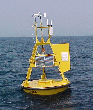
Sailopia.com receives it's data from the NOAA and includes wind, wave, and other marine data collected by the NOAA National Data Buoy Center (NDBC). The data are collected from NDBC moored buoys and from C-MAN (Coastal-Marine Automated Network) stations located on piers, offshore towers, lighthouses, and beaches. Parameters reported by both buoys and C-MAN stations include air temperature and pressure, wind speed and direction, wind gust, and sea surface temperature.
Something of Interest
Sailing is one of the most eco-friendly sports on the planet! with more than 5000 year old technology the sport of sailing is becoming ever more popular in the technological based world. There is nothing greater than to spend a relaxing day on the water!